Lake Merritt field notes: where city water meets the tide
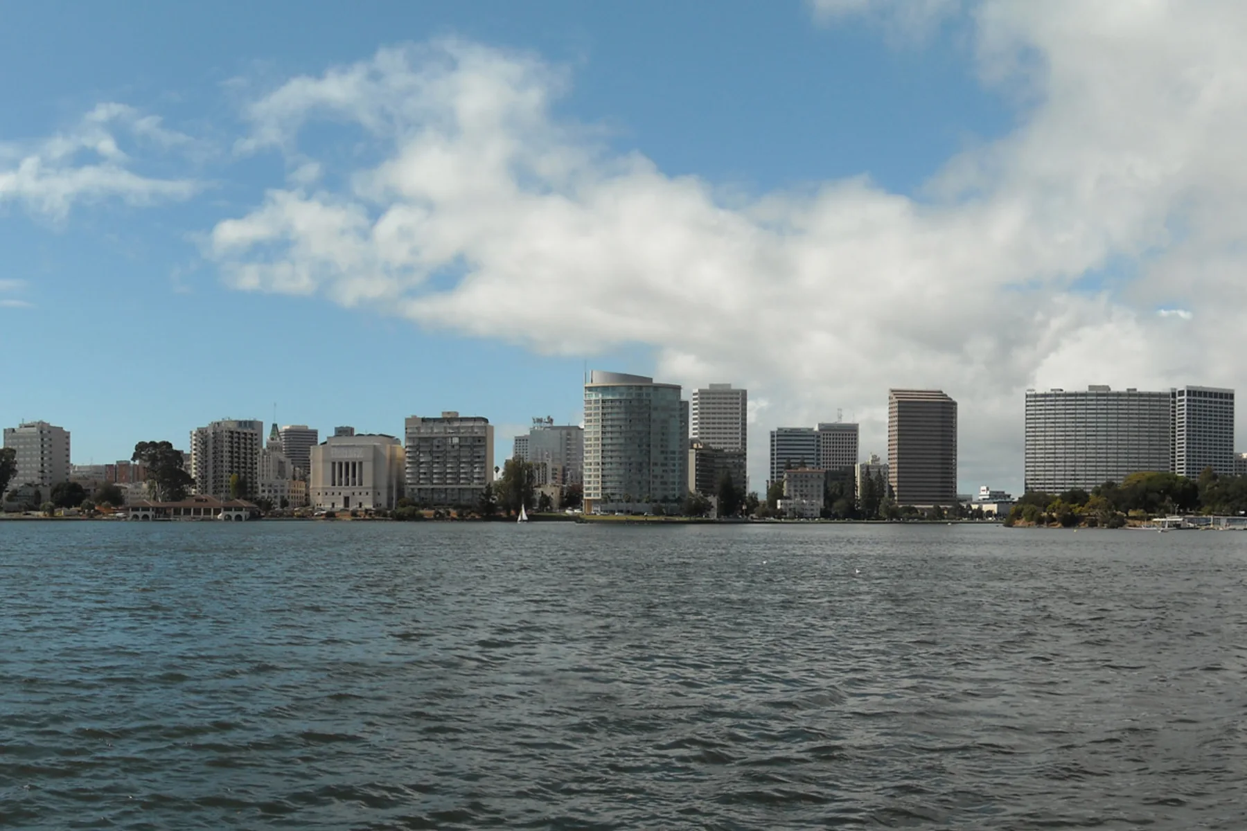
Photo by Daniel Ramirez; cropped, resized and converted from a CC BY 2.0 work.

From the opposite shore, downtown Oakland appears to rise directly from Lake Merritt. The view is civic and scenic, but the water is not an ornamental pond. It is connected to the Oakland Estuary and influenced by tides. Storm drains, rainfall, circulation and nutrients all affect its condition. The city’s water-quality work therefore treats the lake as a living system inside a dense watershed.
History adds another layer. Oakland’s landmark record dates the wildlife refuge designation to 1870. That early protection is widely recognized as the nation’s first official wildlife refuge. The designation did not remove the lake from city life. Instead, habitat, roads, residences, businesses, public gardens and recreation accumulated around the same shoreline.
The skyline photograph captures the resulting compression. Water occupies the foreground, with offices and apartment buildings beyond it. The image does not show every neighborhood that uses the lake, but it suggests why the perimeter functions as common ground. A single circuit passes lawns, boating activity, bird habitat, civic facilities and busy streets.
Environmental conditions can change even when the view seems stable. The City reports on aeration, water circulation, litter and long-term restoration because urban runoff and tidal exchange do not respect visual boundaries. The practical lesson is not that the lake is fragile in only one way; it is that several systems meet there and must be observed together.
Documented context
The City of Oakland sources control the refuge date, historic designation and present restoration description. The interpretation here is deliberately narrower than a travel slogan: Lake Merritt is a cultural center because Oaklanders use it, and an ecological place because water and wildlife continue to behave as parts of an estuary. On the insurance pages, the same division applies. Context helps frame a review, but the policy actually issued controls, including its terms, limits, endorsements and exclusions.
Sources: National Park Service landmark record and Lake Merritt Institute history.
Field observation
A useful field note records conditions rather than guessing at causes. Time, weather, tide, recent rain, visible wildlife and the exact shoreline location all matter. A photograph of one inlet cannot represent the entire lake, and a calm surface cannot establish water quality. City reports and project documents supply the operational context that a casual visit cannot.
The same discipline improves public history. The refuge designation is important, but it sits within Indigenous history, urban development and later restoration decisions. No single plaque can carry all of those timelines. The lake remains a meeting place precisely because it is not one thing: it is water infrastructure, habitat, landmark, path, view and neighborhood edge. Good notes preserve that complexity.
How this page is bounded
The linked public agency pages control the institutional facts stated here, and the licensed image is identified separately. Links are provided so a reader can check the source rather than rely on this summary. Conditions, programs and public access can change; consult the responsible institution for current information. No city feature establishes insurance eligibility or coverage for a nearby address.