Jack London Square and the Port: two waterfront scales
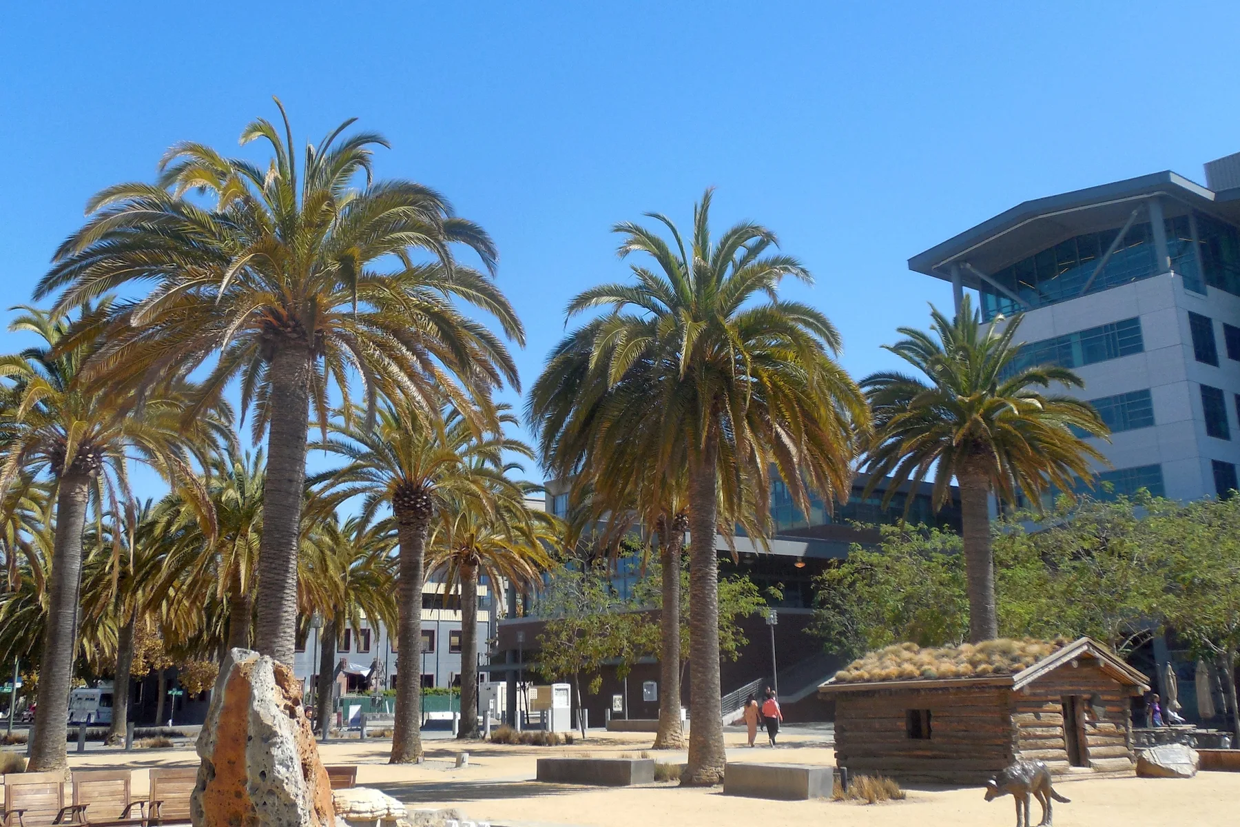
Photo by Niranjan Arminius; cropped, resized and converted from a CC BY-SA 4.0 work.

Jack London Square gives the public a close view of Oakland’s estuary. Palm trees, restaurants, ferry landings, rail tracks and a reconstructed cabin occupy a waterfront that is both transportation corridor and gathering place. The cabin recalls writer Jack London’s Klondike years; nearby Heinold’s First and Last Chance Saloon links the square to the maritime Oakland he knew.
A short distance away, the Port of Oakland operates at a different scale. Established in 1927, the public agency manages maritime, aviation and commercial real estate functions. Its history records Oakland’s 1962 entry into containerized shipping, a change that reorganized waterfront labor and infrastructure around standardized cargo boxes. The cranes are visible from many parts of the city, while most terminal operations remain controlled working space.
These waterfronts share geography but produce different experiences. At the square, the edge invites walking, dining, boating and transit. At the marine terminals, access, timing and safety are coordinated around cargo. Water connects them; rules distinguish them. That combination is characteristic of a port city, where recreation and industry can occupy neighboring stretches without being interchangeable.
The Port’s current materials describe Jack London Square and other shoreline spaces as part of its waterfront-recreation role. Public access therefore sits within the responsibilities of an agency also charged with large transportation systems. The result is not a single-use district but a layered edge shaped by commerce, travel, history and leisure.
Use the operating sources
The Port of Oakland controls its founding date, containerization history and current portfolio description. Its waterfront pages establish the agency relationship to Jack London Square. Those records support the facts here without predicting future tenants, schedules or cargo. A similar boundary governs the insurance guides: a page can explain what to compare, but only the policy actually issued controls coverage, and underwriting determines whether an option is available.
Sources: Port history, About the Port, and waterfront recreation.
One edge, different rules
Field notes from the waterfront should identify whether an observation comes from a public promenade, transit platform, commercial plaza or view toward a secured terminal. The distinction affects what can be seen and why access is managed. Train movements through the square, ferry arrivals and cargo activity follow different operating systems even when they appear in the same panorama.
Historic interpretation needs similar boundaries. Jack London’s name, the reconstructed cabin and Heinold’s are visible reference points, but the waterfront includes many histories beyond one writer. Port records clarify the agency’s chronology and responsibilities; community and labor histories add other perspectives. The strongest account leaves room for those records instead of turning the estuary into a single-brand backdrop.
How this page is bounded
The linked public agency pages control the institutional facts stated here, and the licensed image is identified separately. Links are provided so a reader can check the source rather than rely on this summary. Conditions, programs and public access can change; consult the responsible institution for current information. No city feature establishes insurance eligibility or coverage for a nearby address.